Rising Sea Levels and the Growing Threat to Coastal Communities
A few inches of water can change the shape of daily life. It can close a road, push salt into drinking water, flood a basement, or turn a routine storm into a neighborhood disaster. For coastal communities, rising seas are not a distant problem waiting at the end of the century. They are already changing how people build, insure, commute, farm, fish, and plan for the future.
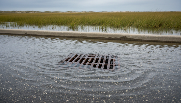
Sea level rise moves slowly enough to feel abstract, then quickly enough to overwhelm systems built for another climate. A seawall designed decades ago may no longer block today’s higher tides. A storm drain may back up during sunny weather. A beach that once buffered homes may shrink year after year.
The threat is not only about water moving inland. It is about risk stacking on top of risk: higher tides, stronger storm surge, eroding shorelines, aging infrastructure, and unequal access to money for recovery. Coastal communities now face choices that are practical, political, emotional, and expensive.

Why seas are rising
Sea level is rising for two main reasons tied to a warming climate.
The first is thermal expansion. As ocean water warms, it expands. Even without adding more water, a warmer ocean takes up more space. Since oceans cover most of the planet, that expansion matters.
The second is melting land ice. Glaciers and ice sheets store huge amounts of frozen water on land. When that ice melts and flows into the ocean, sea levels rise. Melting sea ice, such as floating Arctic ice, does not raise sea level in the same direct way because it is already in the water. Land ice is the larger concern.
Global average sea level has risen by more than eight inches since the late 19th century, based on long-running scientific measurements. The pace has increased in recent decades. Local sea level can rise faster or slower than the global average because of land movement, ocean currents, erosion, and groundwater withdrawal.
That local piece matters. A coastal town built on sinking land may see water rise faster relative to its streets, even if the global ocean average tells a calmer story. In some places, the land itself is compacting. In others, tectonic movement changes the shoreline. The result is uneven exposure, even among communities only a short drive apart.
The damage does not start at the shoreline
When people picture sea level rise, they often imagine waves reaching front porches. That happens in some places, but the first signs are often less dramatic.
They show up as:
More frequent nuisance flooding during high tides
Storm drains that stop draining because the outfall sits below water
Saltwater moving into freshwater wells and aquifers
Septic systems failing in saturated ground
Beach erosion that removes natural storm protection
Wetlands drowning when they cannot migrate inland
Roads, bridges, and rail lines closing more often
This is why the phrase coastal flooding covers much more than water on a beach. It includes the hidden systems below streets and behind homes. A tide that barely reaches the curb can still push water backward through pipes. A small amount of saltwater can damage soil, corrode infrastructure, and make drinking water harder to manage.
Storm surge adds another layer. Higher seas give storms a higher starting point. That means the same storm can reach farther inland than it would have in the past. A few inches of background sea level rise can increase the area reached by floodwater, especially on flat coastal plains.
This does not mean every coastal place faces the same future. Rocky coastlines, barrier islands, river deltas, marshes, and urban waterfronts all respond differently. Still, the pattern is clear: water is reaching places that were designed around older assumptions.
Coastal communities face more than physical risk
Rising water creates economic and social pressure long before a home is permanently flooded. Insurance may become harder to afford. Lenders may view some properties as riskier. Municipal budgets may stretch under the cost of road repairs, pump stations, beach nourishment, and emergency response.
For households, the burden can be uneven. Wealthier property owners may elevate homes, install flood barriers, or move. Lower-income residents may have fewer choices, even when they face higher exposure. Renters often have little control over building improvements. Older adults, people with disabilities, and families without reliable transportation may face extra danger during evacuations.
The cultural costs can be just as serious. Coastal places are not only parcels on a map. They hold family histories, fishing traditions, tribal lands, ports, tourism economies, churches, schools, and cemeteries. Moving away from the water can mean leaving behind identity as well as property.
This is one reason adaptation debates become difficult. A map may show that retreat makes sense in one low-lying area, but residents may see a lifetime of work and memory. Public officials may know a road floods too often, but closing or relocating it can divide a community. Builders may push for protection, while ecologists warn that hard barriers can worsen erosion nearby.
The growing threat to coastal communities is not only that water rises. It is that decisions get harder when the timeline is uncertain, the costs are high, and the people most at risk may have the least power to shape the response.
Nature can protect shorelines, but it needs room
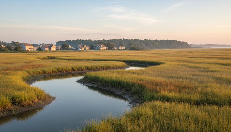
Not every solution has to be made of concrete. Natural features can absorb wave energy, store floodwater, trap sediment, and reduce erosion. Marshes, dunes, mangroves, oyster reefs, and barrier beaches have protected coastal settlements for generations.
These systems work best when they have space to shift. A marsh can survive sea level rise if it builds upward with sediment or moves inland. If roads, seawalls, or buildings block that movement, the marsh can get squeezed between rising water and fixed development. Scientists often call this coastal squeeze.
Healthy dunes also need room. They move with wind and waves. After storms, sand can wash inland and help rebuild the system. When buildings sit too close, communities often try to hold dunes in place, which can weaken their natural function over time.
Nature-based protection has limits. A restored marsh will not stop every storm surge. A dune cannot defend every dense waterfront. Still, these approaches can reduce everyday flooding, improve habitat, and buy time. They can also work alongside engineered structures.
A strong coastal plan often combines several tools:
Natural buffers
Built defenses
Land-use changes
Emergency planning
Marsh restoration, dune rebuilding, living shorelines, oyster reefs, and mangrove protection where conditions allow
Seawalls, tide gates, pumps, raised roads, floodproofed utilities, and elevated buildings
Updated zoning, open-space buffers, buyouts, setbacks, and limits on repeated rebuilding in high-risk zones
Clear evacuation routes, flood warnings, shelters, backup power, and plans for people with limited mobility
The best mix depends on the location. A fishing village, a major port, a barrier island town, and a low-income urban neighborhood may need very different plans.
Adaptation means making hard choices early
Waiting can feel cheaper, but delay often raises the cost. When communities wait until damage becomes frequent, they have fewer options and less time to act. Emergency repairs tend to cost more than planned improvements. Rebuilding the same vulnerable asset again and again can drain public funds.
Adaptation starts with knowing what is at risk. That means mapping not only shorelines, but also roads, power systems, schools, wastewater plants, hospitals, wells, and evacuation routes. It also means looking at future conditions rather than relying only on past flood records.
A floodplain map based on yesterday’s water levels may not show tomorrow’s risk. Communities need planning tools that account for higher seas, heavier rainfall in some regions, and stronger storm impacts where those threats overlap.
Good adaptation also requires honest public conversation. Residents need clear information about what protections can and cannot do. A seawall may protect one area while pushing wave energy somewhere else. Elevating a road may keep traffic moving but worsen flooding on nearby land if drainage is not handled well. Beach nourishment can support tourism and buffering, but it may need repeated funding.
Some neighborhoods will defend. Some will elevate. Some will redesign. Some, over time, may relocate. None of those choices are simple. The worst outcome is making no choice while risk quietly grows.
What stronger coastal planning looks like
A serious response to rising seas is practical, local, and long term. It does not rely on one giant project or one grant cycle. It treats sea level rise as a condition that affects housing, transportation, public health, ecosystems, and budgets.
Strong planning often includes these steps.
Use updated risk data
Communities need maps and models that show different sea level scenarios. A single projection can create false confidence. Scenario planning helps leaders test decisions against a range of possible futures.
Protect critical services first
Hospitals, water treatment plants, power substations, emergency routes, and communication systems deserve priority. If those fail during floods, the harm spreads quickly.
Build with future water levels in mind
New development should account for the expected life of the structure. A building meant to last 50 years should not be designed only for current tides.
Avoid putting more people in harm’s way
Growth near the coast can bring jobs and housing, but risky development creates future losses. Smart land-use rules can reduce repeated damage.
Fund maintenance, not only new projects
Pumps, tide gates, dunes, drains, and wetlands all need care. A plan that pays for construction but not upkeep will weaken over time.
Center the people most exposed
Public meetings do not always reach renters, shift workers, older residents, tribal communities, or people who speak languages other than English. Coastal planning works better when those voices shape decisions from the start.
This is where national policy and local knowledge need to meet. Federal and state funding can support large projects, but residents often know which streets flood first, which shelters are hard to reach, and which drainage fixes have failed before.

The future is not fixed, but the window is narrowing
Rising seas will keep reshaping coasts for generations because oceans respond slowly to heat already stored in the climate system. That does not mean the scale of damage is already locked in. Choices made now can reduce harm.
Cutting heat-trapping pollution can slow the pace over time. Better building codes can prevent avoidable losses. Restored wetlands can soften waves. Smarter zoning can keep new homes away from the highest-risk areas. Fair buyout programs can help some residents move before disaster forces the issue. Stronger evacuation planning can save lives during storms.
The key is to stop treating sea level rise as a rare coastal issue. It is a housing issue, a transportation issue, a drinking water issue, an insurance issue, and a public safety issue. It affects local tax bases, ecosystems, food systems, and cultural heritage.
Coastal communities have always adapted to water. They built ports, raised docks, managed fisheries, and learned storm seasons. The challenge now is the speed and scale of change. Planning for higher seas will not remove every risk, but it can decide whether the next decades bring managed adjustment or repeated crisis.
The water is rising. The most useful question is no longer whether coastal communities should prepare, but how quickly and how fairly they can begin.


Comments